The Pacific Northwest is a gorgeous place to fly. We have mountains, coastal areas, bays, rivers, lakes, mountains, deserts, and many different kinds of forest. But risk accompanies this variety. The high desert and the mountains often mean high density altitude. The ocean and the mountains both create wind shear. Rugged terrain often means fewer "outs", or safe landing places in the case of trouble. And the PNW is the "icing capital" of the lower 48 states.
This page is dedicated to the idiosyncrasies of flying in the PNW in general, and the Columbia Gorge region in particular. Great Wave Aviation is based at the Ken Jernstedt Airfield, 4S2. On the CTAF (common traffic advisory frequency) of 122.8, 4S2 is known as "Hood River traffic". Let's look together at the part of the VFR sectional chart that depicts Hood River.
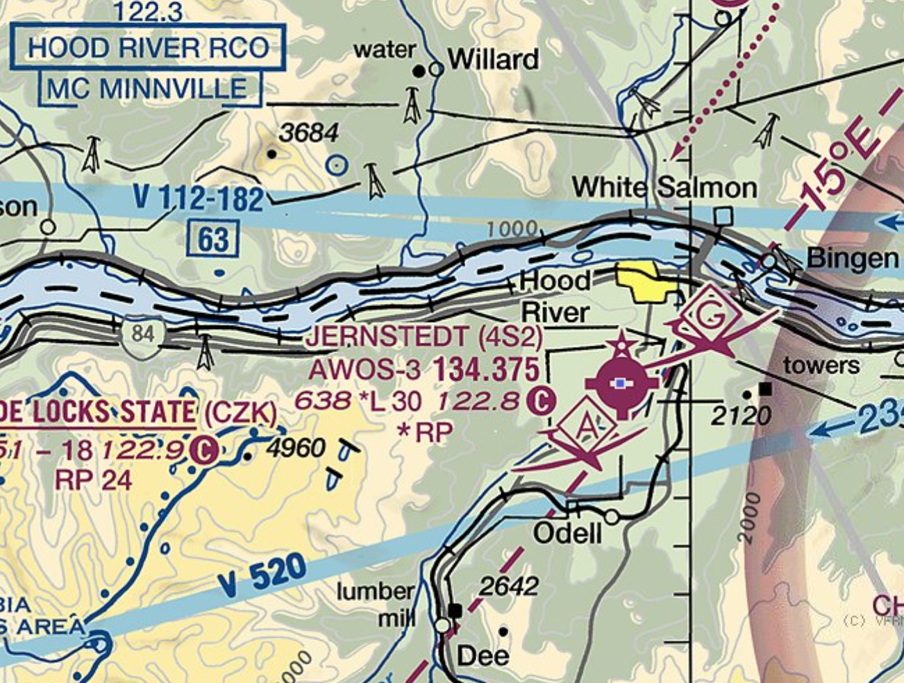
Table of Contents
- Hood River Gliders
- Hood River AGLA
- Hood River Winds
- Other Hood River Features
- Pacific Northwest Destinations
Hood River Gliders
Airport flight patterns are assumed to be based on left hand turns unless otherwise indicated. To the west, Cascade Locks State airport shows "RP 24", notifying us that there is an exception to the left hand turn rule. Runway 24 is to be flown as a right turn pattern. Runway 6 is left hand turns, as normal. For 4S2, the chart shows "*RP". This does not mean that 4S2 is a right hand pattern. The star indicates that there is something non-standard at 4S2, and we should look in the Chart Supplement to discover what that is. Doing so, we learn that Hood River is a left pattern airport, but that gliders fly a right pattern. On the VFR sectional, just above the airport we see the symbol for glider activity. Gliders are slower than powered aircraft and they can be hard to see, so putting glider traffic on a right pattern helps prevent accidents. Gliders have the right of way over powered aircraft.
Hood River AGLA
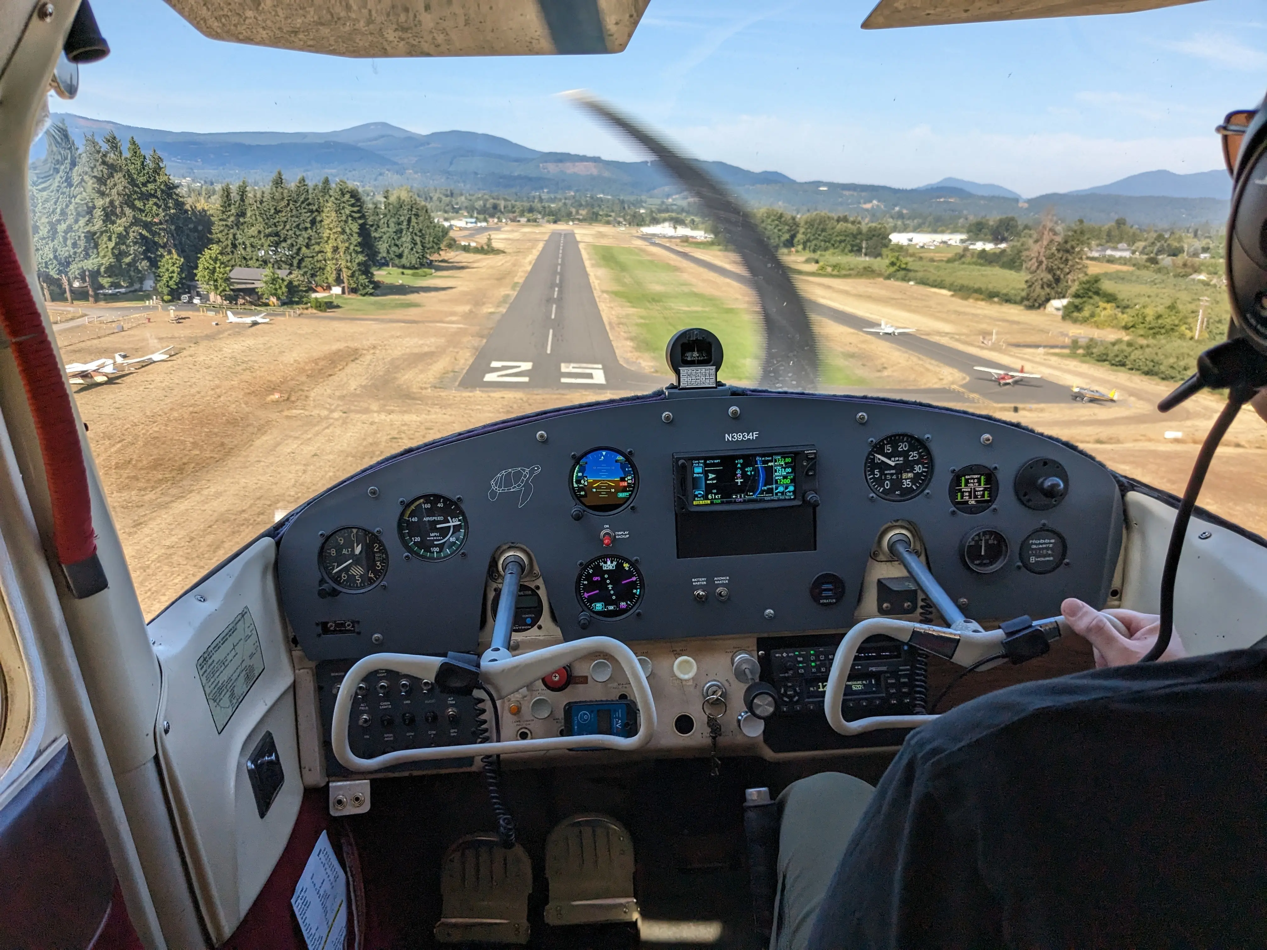
Another interesting feature of 4S2 is the AGLA, or Alternate Grass Landing Area. Hood River only has one runway: 25-7. But just to the north of the paved runway lies the AGLA, which can be used instead of the paved runway, and is called out as "25 grass" or "7 grass". The paved runway cannot be used simultaneously with the AGLA. And planes taxiing to runway 25 on the north taxiway must hold short at the appropriate sign when traffic is taking off or landing on the AGLA.
Hood River Winds
The Hood River Valley descends from Mt. Hood down to the Columbia River, and is bounded on the east by a 2000 foot plus ridge, and on the west by hilly terrain rising up to around 5000 feet. Winds are typically westerly - occasionally easterly. Either way, there is rotor coming off the hills, creating some excitement for local pilots. The Columbia Gorge itself acts as a giant wind funnel, taking what is merely a breeze in the Portland/Vancouver area and turning it into (sometimes) gale force winds by the time it hits our neighborhood. And given that the final approach to runway 25 in Hood River passes directly over the Hood River canyon, there is often wind shear on final approach.
Other Hood River Features
West of Hood River, you can see the border of a special conservation area, which in this case is a wilderness area. The solid blue line with the dots inside shows the border. Pilots are requested to remain at least 2000 feet AGL when flying over these zones. The PNW has many such conservation areas.
Let me now draw your attention to the magnetic variation, which is 15 degrees east, and is represented on the chart by the dashed line. If you are navigating with your magnetic compass and the lubber line reads 350 degrees, then you would add 15 degrees to 350 to get your true heading, which would be 5 degrees. A 15 degree difference can add up when you are navigating by dead reckoning, potentially putting you miles off course and creating a fuel shortage.
There is quite a wealth of information on aviation charts. The "A" symbol just below the airport tells us that the Hood River traffic area is also designated as an area of aerobatic activity. But leaving FAA charts behind for the moment, you can also learn about the Hood River airport on the website of the Port of Hood River at portofhoodriver.com/airport.
Pacific Northwest Destinations
TBA!